CONTINUE READING Disasters 1 min read
Posted in
Posted in
Government agencies and municipal planners rely on accurate, up-to-date aerial data for better decision-making. Our drone imagery captures urban areas, road networks, and public spaces in high resolution, providing a clear overview for city planning and management. From zoning analysis to infrastructure assessment, our clean mapping style reveals details like green spaces, traffic routes, and […]
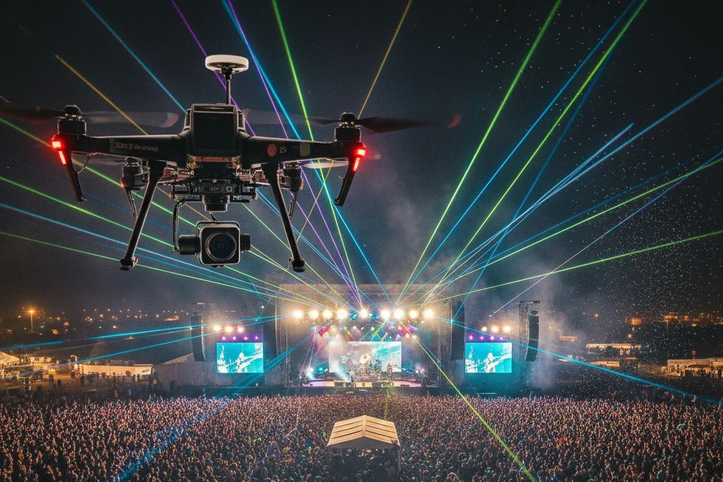
We bring cinematic storytelling to new heights. Our aerial cinematography captures the scale, emotion, and depth that traditional cameras can’t reach. From sweeping coastline scenes to dramatic cityscapes, we deliver film-quality visuals that captivate audiences. Each shot is carefully planned for composition, lighting, and motion. Golden hour visuals, smooth horizon lines, and color-graded tones produce […]
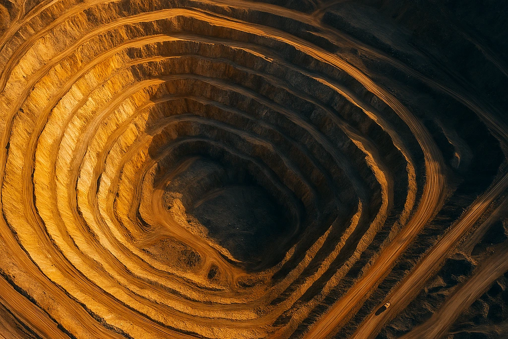
Mining and energy operations demand precision and consistency. Our high-altitude aerial mapping provides detailed visual and volumetric data to improve planning, logistics, and environmental safety across extraction sites. Orthophotos and 3D surface models of open-pit mines reveal terraced slopes, haul roads, and excavation depth with volumetric accuracy. This data assists in tracking stockpiles, measuring extraction […]
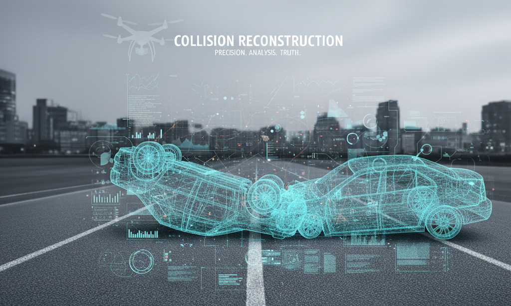
Collision scenes tell a story — our job is to make sure the facts are clear. What Is Collision Reconstruction? Collision reconstruction is the science of recreating accident scenes from captured imagery. Using photogrammetry, we measure distances, positions, and trajectories directly from overlapping photographs. These reconstructions allow investigators, insurance experts, and legal teams to review […]
Industrial inspections require precision, safety, and speed. Our aerial imaging services for power plants, pipelines, and infrastructure provide a bird’s-eye view of assets while eliminating the need for dangerous manual inspections. Each mission captures ultra-clear imagery and video for accurate condition assessments. We map out utility structures—towers, rooftops, substations, and maintenance zones—using high-resolution orthographic perspectives. […]
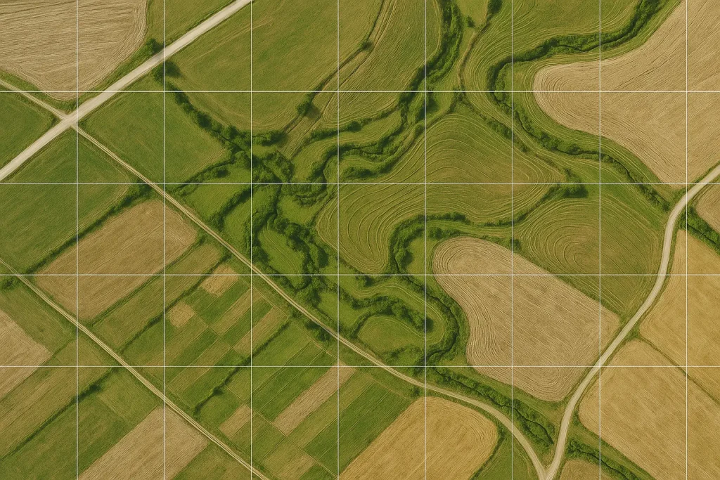
Our drone-based agriculture and environmental monitoring solutions help farmers, researchers, and land managers make data-driven decisions with accuracy. Using NDVI and multispectral analysis, we identify crop health variations, irrigation inefficiencies, and soil moisture imbalances across entire fields. High-altitude orthographic images reveal color-coded health zones, providing visual insight into nutrient deficiencies and early signs of disease. […]
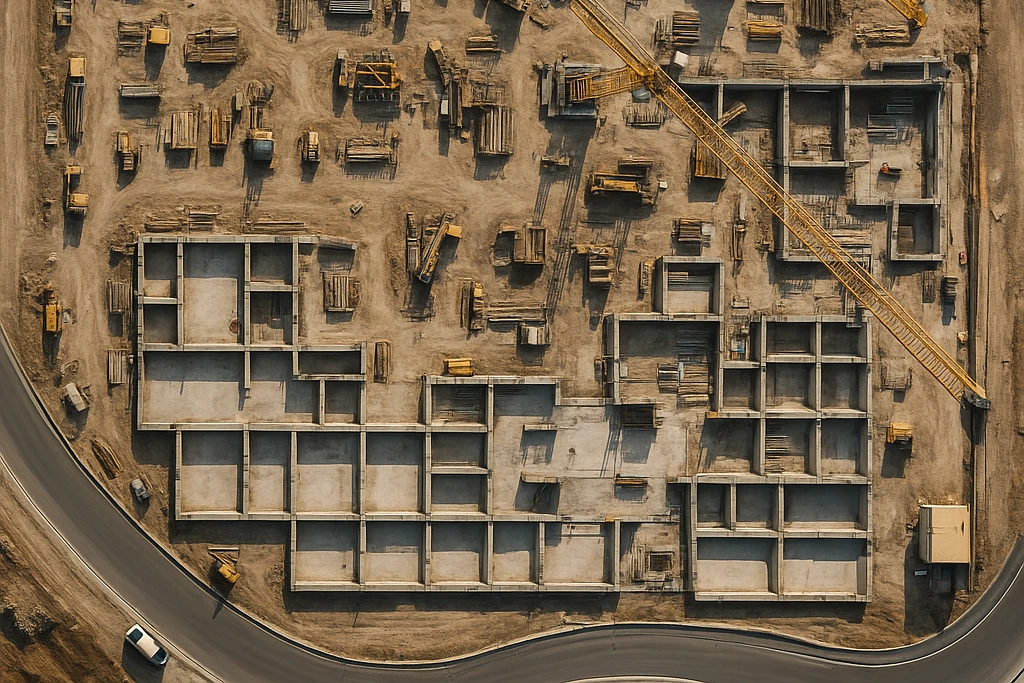
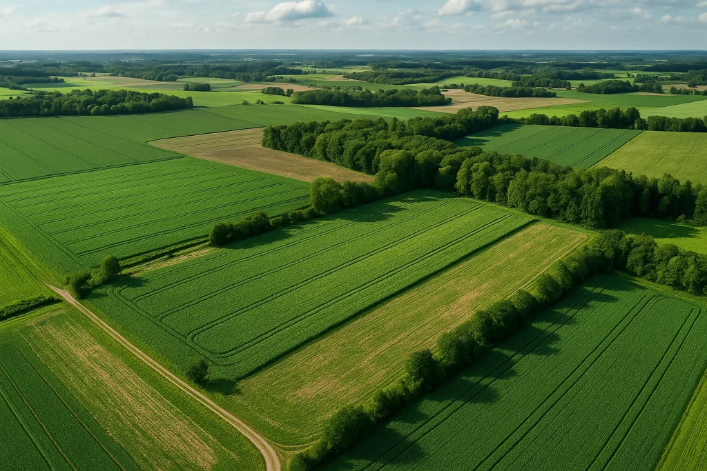
Precision from Above. Data You Can Trust. Aerial mapping and surveying provide the foundation for precision analysis and accurate data collection across industries. Using advanced photogrammetry and high-resolution imaging, we deliver ultra-detailed orthomosaic maps that reveal every contour, elevation, and boundary of your project site. Our team ensures every image is georeferenced and precisely stitched […]
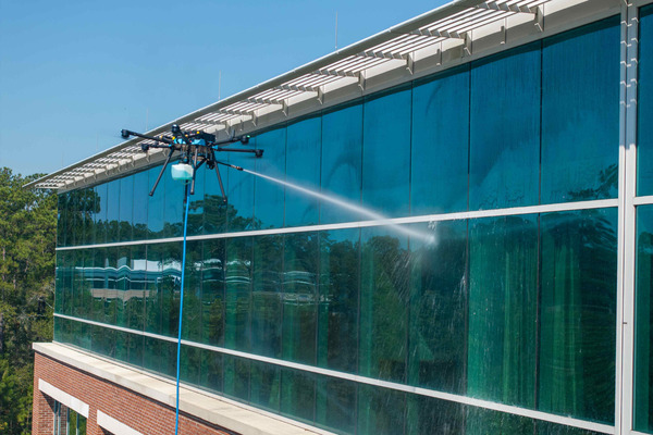
Smart, Safe, and Scalable Building Maintenance At Birdseye Unmanned, we’ve redefined how high-rise and large-structure maintenance is done. Using the cutting-edge Sherpa drone by Lucid Bots, we offer a complete exterior cleaning and inspection solution—eliminating the need for scaffolding, lifts, or workers suspended hundreds of feet in the air. Our aerial cleaning systems combine precision […]
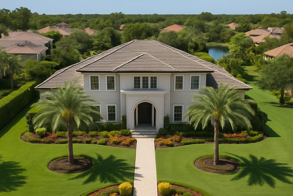
Aerial photography has revolutionized the way real estate professionals showcase properties. Our cinematic aerial imaging captures luxury homes, commercial spaces, and land developments from stunning new perspectives, offering clients and buyers a complete view of their investment. Each aerial shoot is conducted under optimal lighting and conditions to produce sharp, vibrant visuals. The result: a […]